Showing posts with label thirteeners. Show all posts
Sunday, July 6, 2014
Sunday, September 26, 2010
Mount Sniktau, Colorado
I’d considered taking Cameron to Mount Sniktau (13, 234 feet) for his first big hike, instead of to Bierstadt; Sniktau is easier than Bierstadt, and quite a bit shorter (only 3.4 miles round-trip). However, in the end, I figured he’d prefer to climb a relatively popular fourteener than some little-heard-of thirteener. Good thing - if Mount Sniktau had been my first hike, I would have never hiked again.
I overslept this morning, by five hours; instead of getting up at five, I turned off my alarm and slept until ten. But the weather report was good and the sky was clear, so I thought I might as well give it a try. I got to Loveland Pass (11,990 feet) around noon and immediately set off in the wrong direction.
An hour later, I was back at Loveland Pass and this time, I actually used the map and took the right trail. Hiking up Mount Sniktau is a pain; it’s just a straight shot up the mountain, no switchbacks or anything. Despite my false start, it’s very clear where you’re supposed to go, and there are even some stupid cairns sitting next to the trail, which is wide enough for like eight people to walk side-by-side. I obviously didn’t need the map much after the initial direction-correction, so I put it in my boot to keep my heel from getting rubbed raw.
It took me an hour and forty minutes to get up, and only a half-hour to get down - I think that’s my speed record. In conclusion, Sniktau is a dull unappealing uphill slog that should only be attempted by masochists, and I’m glad to have it out of the way.
I overslept this morning, by five hours; instead of getting up at five, I turned off my alarm and slept until ten. But the weather report was good and the sky was clear, so I thought I might as well give it a try. I got to Loveland Pass (11,990 feet) around noon and immediately set off in the wrong direction.
An hour later, I was back at Loveland Pass and this time, I actually used the map and took the right trail. Hiking up Mount Sniktau is a pain; it’s just a straight shot up the mountain, no switchbacks or anything. Despite my false start, it’s very clear where you’re supposed to go, and there are even some stupid cairns sitting next to the trail, which is wide enough for like eight people to walk side-by-side. I obviously didn’t need the map much after the initial direction-correction, so I put it in my boot to keep my heel from getting rubbed raw.
Saturday, July 10, 2010
The CT Clipper (Clinton Peak, Mount McNamee, and Mount Traver), Colorado
Something Glenn said during this weekend’s trip really stuck in my mind; roughly paraphrased, he mentioned that hiking is something that you don’t really enjoy until after it’s done and you’re home reflecting in your massage chair. At the time, I probably just scowled at him, but there’s a lot of wisdom in those words. If you would have asked me on Sunday while I was freezing and wet to the bone trudging through the weather if I was having a good time, I would have bitten your face off; but looking back, I’m quite pleased with the whole experience. I feel accomplished and game for another go.
The route we did was called the Clinton-Traver Clipper, or CT Clipper, although we did it backwards - the TC Clipper. Clinton Peak is part of the Mosquito Range near Leadville, and our plan was to summit it, as well as two unranked peaks nearby, Traver and McNamee.
A note on unranked peaks: while Traver and McNamee are both technically thirteeners (13,852 and 13,780 feet, respectively), some unwritten statute of mountaineering common law states that if a peak does not rise 300 feet from the ridge, or saddle, that connects it to another peak, it is not considered an official peak. So of the three we did, only Clinton really “counts.”
We were already hours behind schedule when we started off from the Montgomery Reservoir trailhead. The guidebook we were using underplayed the roughness of the 4WD terrain and we weren’t able to drive as far in as we had planned, adding extra miles to our hike before we’d even started.
We passed a lot of old remnants of mining operations, and our first milestone was Wheeler Lake, which almost cartoonishly idyllic, surrounded by the bright green grasses dotted with wild flowers.
It was getting late in the day by this point for hiking up mountains - rule-of-thumb is to finish before noon, when afternoon thunderstorms can make hiking uncomfortable at the best and perilous at the worst. Those extra miles at the start really threw off our timing - the clouds overhead were getting a little grayish around the gills, but Glenn and I would not move before the mountain; we headed up anyway, hoping to get a better idea of our weather situation from higher up. We started gaining altitude pretty quickly after the lake, hopping over the broken stones, called talus, up to reach the valley surrounded by Clinton and his ilk.
As we climbed/hiked further and further up the mountain to Traver Peak, my spirits were plummeting. I felt light-headed and cold, I was fighting sudden stabs of nausea - altitude sickness, says Glenn, drink more water - and frustrated, because no matter how far I walked, the summit was not getting any closer!
But I guess all that walking really did get us somewhere, because next thing I know, I’m standing amid a bunch of debris and rock cairns and I’m higher than most everything else around me.
Our next step was walking along the ridge to McNamee and Clinton Peaks, which was a lot less narrow than I’d feared when I was looking up at it, but I was still feeling sick. Glenn gave me some cheddar crackers to eat, and thus galvanized, I toughed it out to Clinton, breaking my previous altitude record (Traver Peak) by five feet; Clinton tops out at 13,857 feet.
Chained to one of the rock piles on the summit was a PVC tube with the summit log in it. It was a photocopy of a couple pages from a guidebook (the same guidebook Glenn and I had used, actually) with a bunch of people’s names scribbled on it, along with the date of their summit. I scrawled our name on it along with the date, and put it back in the tube. Glenn says that occasionally someone will come along and collect the paper and file it away with all the other papers covered in the names of everyone else who’d summited the mountain.
I really thought the worst was over; I’d summited three peaks, I hadn’t fallen off the mountain, and I hadn’t keeled over from exhaustion - it was all downhill from here! Unfortunately, downhill from Clinton entailed slipping and sliding down a steep length of extremely loose scree.
The trick, said Glenn, is to dig your heel in and sort of slide down with the tumbling rocks. And sure enough, he plodded down, steady as a mountain goat. I found the terrain a lot more challenging, and all my previous frustration and exhaustion snowballed until I’d worked myself into a truly foul mood, and I made my way unsteadily downward trying not to cry. “There’s no point in crying now, you have no choice, there’s nothing to be done but go through with it. You can cry when you’re done,” I told myself. And it kind of worked, until the weather came.
We’d been extraordinarily lucky thus far, that those ugly gray clouds had skipped our mountains entirely, but as we were walking back down the valley, it clouded over and started raining. I had been holding onto this foolish hope that we might run into a friendly four-wheeler at Wheeler Lake who’d be willing to give us a ride back to the trailhead, even though it was around five or six at that point, and the weather would surely have chased away anybody hanging out at the lake long before we got back there.
Happily, the cold numbed my body effectively enough that I was able to forget about my pains and make pretty good time back to the trailhead. Believe it or not, the worst thing about that miserable trip back was my pants, which were falling down the whole time. I mean, rain happens. Cold happens. Sore happens. But fearing that I was about give Glenn a show should my pantleg get caught on an errant branch? That’s just annoying. Glenn said that I did “really well,” given the circumstances, although he did say it before I really started in on the crying jags and shooting him nasty glances. Hiking really brings out all the worst parts of my personality.
When we got home, all I wanted to do was look pretty, be warm, and play videogames. I took a shower, and even though I had to wash my hair with a bar of soap and I couldn’t shave and I had nothing to wash my face with, it was one of the best showers I’d ever taken. All in all, the hike was 10 miles and took us more than 10 hours - not bad for a noob.
The route we did was called the Clinton-Traver Clipper, or CT Clipper, although we did it backwards - the TC Clipper. Clinton Peak is part of the Mosquito Range near Leadville, and our plan was to summit it, as well as two unranked peaks nearby, Traver and McNamee.
A note on unranked peaks: while Traver and McNamee are both technically thirteeners (13,852 and 13,780 feet, respectively), some unwritten statute of mountaineering common law states that if a peak does not rise 300 feet from the ridge, or saddle, that connects it to another peak, it is not considered an official peak. So of the three we did, only Clinton really “counts.”
We were already hours behind schedule when we started off from the Montgomery Reservoir trailhead. The guidebook we were using underplayed the roughness of the 4WD terrain and we weren’t able to drive as far in as we had planned, adding extra miles to our hike before we’d even started.
We passed a lot of old remnants of mining operations, and our first milestone was Wheeler Lake, which almost cartoonishly idyllic, surrounded by the bright green grasses dotted with wild flowers.
It was getting late in the day by this point for hiking up mountains - rule-of-thumb is to finish before noon, when afternoon thunderstorms can make hiking uncomfortable at the best and perilous at the worst. Those extra miles at the start really threw off our timing - the clouds overhead were getting a little grayish around the gills, but Glenn and I would not move before the mountain; we headed up anyway, hoping to get a better idea of our weather situation from higher up. We started gaining altitude pretty quickly after the lake, hopping over the broken stones, called talus, up to reach the valley surrounded by Clinton and his ilk.
As we climbed/hiked further and further up the mountain to Traver Peak, my spirits were plummeting. I felt light-headed and cold, I was fighting sudden stabs of nausea - altitude sickness, says Glenn, drink more water - and frustrated, because no matter how far I walked, the summit was not getting any closer!
| There are a lot of pictures of me sitting down on this hike. |
| I can honestly say this is the most beautiful view I've ever seen. Too bad the Invisible Man is in the way. |
| Making progress around the horseshoe. The bump on the right is McNamee and the bump on the left is Clinton. |
Chained to one of the rock piles on the summit was a PVC tube with the summit log in it. It was a photocopy of a couple pages from a guidebook (the same guidebook Glenn and I had used, actually) with a bunch of people’s names scribbled on it, along with the date of their summit. I scrawled our name on it along with the date, and put it back in the tube. Glenn says that occasionally someone will come along and collect the paper and file it away with all the other papers covered in the names of everyone else who’d summited the mountain.
I really thought the worst was over; I’d summited three peaks, I hadn’t fallen off the mountain, and I hadn’t keeled over from exhaustion - it was all downhill from here! Unfortunately, downhill from Clinton entailed slipping and sliding down a steep length of extremely loose scree.
The trick, said Glenn, is to dig your heel in and sort of slide down with the tumbling rocks. And sure enough, he plodded down, steady as a mountain goat. I found the terrain a lot more challenging, and all my previous frustration and exhaustion snowballed until I’d worked myself into a truly foul mood, and I made my way unsteadily downward trying not to cry. “There’s no point in crying now, you have no choice, there’s nothing to be done but go through with it. You can cry when you’re done,” I told myself. And it kind of worked, until the weather came.
We’d been extraordinarily lucky thus far, that those ugly gray clouds had skipped our mountains entirely, but as we were walking back down the valley, it clouded over and started raining. I had been holding onto this foolish hope that we might run into a friendly four-wheeler at Wheeler Lake who’d be willing to give us a ride back to the trailhead, even though it was around five or six at that point, and the weather would surely have chased away anybody hanging out at the lake long before we got back there.
| Not quite as welcoming as before. |
When we got home, all I wanted to do was look pretty, be warm, and play videogames. I took a shower, and even though I had to wash my hair with a bar of soap and I couldn’t shave and I had nothing to wash my face with, it was one of the best showers I’d ever taken. All in all, the hike was 10 miles and took us more than 10 hours - not bad for a noob.
Labels:
Clinton Peak,
Colorado,
hiking,
Mount McNamee,
Mount Traver,
thirteeners
Saturday, June 19, 2010
Sunrise Couloir and Mount Spalding, Colorado
I got up at five on Sunday morning and wore hiking boots and long Johns to join Glenn on a snow climb and a hike. Snow climbing, for people who, like me until recently, do not know, entailed stabbing an ice axe into the ground to secure myself while I kicked “stairs” into the snow so I could step up. The axe, when used properly (emphasis on “when used properly”) also stops you from sliding helplessly down the slope of the mountain until large piles of huge pointy rocks break your fall. I tripped/stumbled/faceplanted too many times to count, and I fell into a real slide (“unintentional glissade,” said Glenn) three times; the first time was heartbreakingly spectacular - fifty feet of progress gone in seconds! - but I'd gotten the hang of stopping myself using the axe before I fell too far after that.
My scariest moment was when I slipped my right foot into what Glenn called a “moat,” the soft snow that occurs around rocks after they heat up in the sun, and I ended up sitting in the snow with one leg dangling over the abyss and the other still digging into my last step. I don’t know how the science works, that I couldn’t fit my foot back through the hole that I had just plunged it into, but I knew my number was up. I’d just have to make a home there until the snow I was sitting on broke too, and then the fall would put me out of my misery. BUT SOMEHOW I SQUIRMED OUT! The human body is capable of truly incredible things when it thinks it’s going to die.
We began from Summit Lake at 12,000 feet. This terrain is tundra, so now I know what my teacher was going on about when we were learning biomes in bio. There are lots of tiny ponds there separated by these clumps of dry grasses.
It was kinda steep! The strip is called Sunrise Couloir (the French word for “corridor”), and it is a Class 3 route, which means that it involves “scrambling or un-roped climbing. You must use your hands most of the time to hold the terrain or find your route. This may be caused by a combination of steepness and extreme terrain (large rocks or steep snow).”
After a hard trip up, we had a choice to make: go left and hike up Mt. Evans, or go right and do the lesser Mount Spalding. Glenn advised the latter, which was good because after we’d been hiking for a while, I started feeling pretty badly. But I still made it to the summit (13,842 feet).
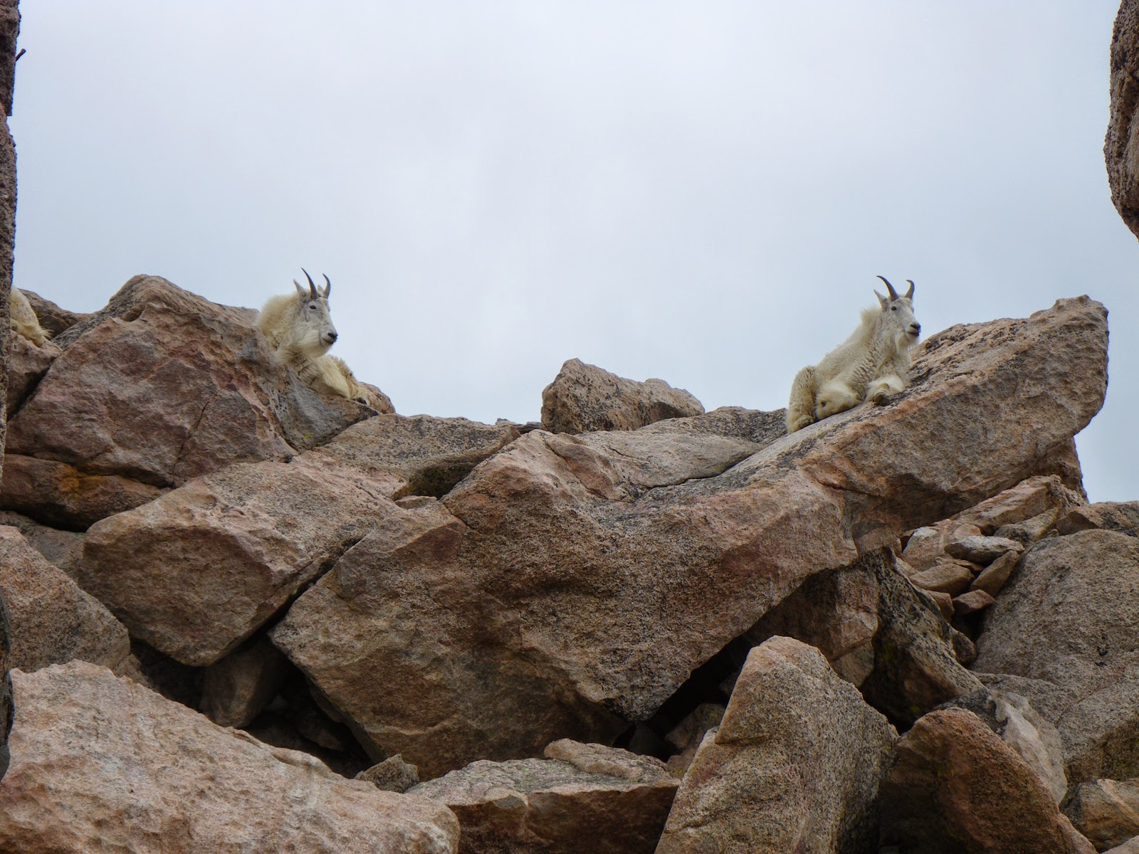
Then we made the drive up to Mt. Evans, because I haven’t been since OEL ten years ago. We saw some mountain goats and a pika, which is like a chirping hamster-squirrel. I also saw marmots, which are super-fat gophers with twirly tails.
The goats started looking awful good, so on the way home, we stopped by Idaho Springs for a burger and duck drumsticks, and we walked over to the Charlie Tayler water wheel. According to the little historical plaque by the wheel, Charlie Tayler, a miner, “attributed his good health to the fact that he never kissed women or took baths.”
Anyway, the climb was indescribably awesome. I don’t know how I’m going to go back to spending my weekends not sliding fifty feet down a mountain slope backwards.
My scariest moment was when I slipped my right foot into what Glenn called a “moat,” the soft snow that occurs around rocks after they heat up in the sun, and I ended up sitting in the snow with one leg dangling over the abyss and the other still digging into my last step. I don’t know how the science works, that I couldn’t fit my foot back through the hole that I had just plunged it into, but I knew my number was up. I’d just have to make a home there until the snow I was sitting on broke too, and then the fall would put me out of my misery. BUT SOMEHOW I SQUIRMED OUT! The human body is capable of truly incredible things when it thinks it’s going to die.
| Me and my climb, the strip of snow to the left of the picture. |
| In the thick of it. |
| I'm not the kind of person that usually appreciates the cheap showiness of nature, but this view of the Chicago Lakes from the Spalding summit was exquisite. |
The goats started looking awful good, so on the way home, we stopped by Idaho Springs for a burger and duck drumsticks, and we walked over to the Charlie Tayler water wheel. According to the little historical plaque by the wheel, Charlie Tayler, a miner, “attributed his good health to the fact that he never kissed women or took baths.”
Anyway, the climb was indescribably awesome. I don’t know how I’m going to go back to spending my weekends not sliding fifty feet down a mountain slope backwards.
Labels:
Colorado,
Mount Spalding,
snow climbing,
thirteeners
Subscribe to:
Posts (Atom)